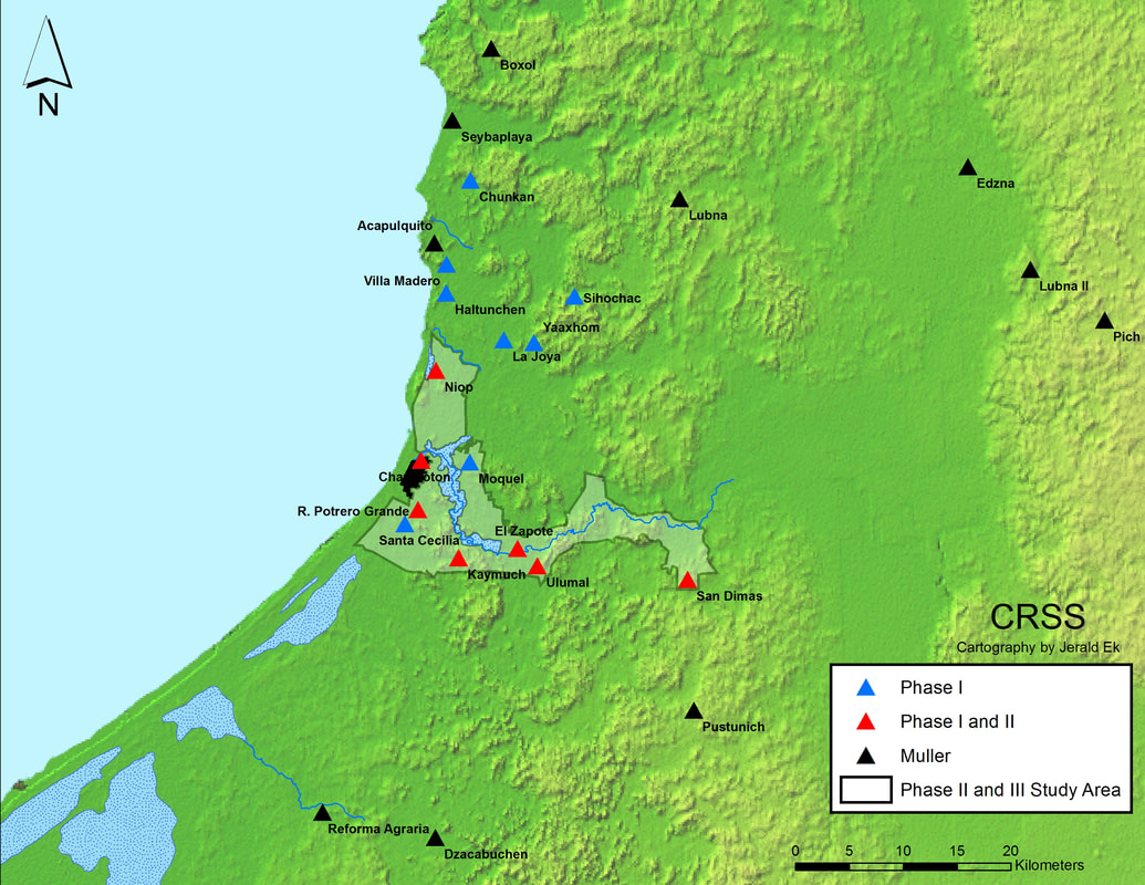
Figure 1: The Champotón Regional Settlement Survey, Phase 1 Reconnaissance Zone
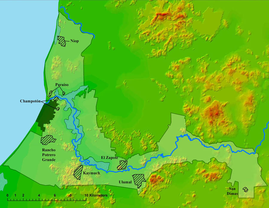
Figure 2: The CRSS Phase 2 Intensive Survey Zones and Coverage Areas.
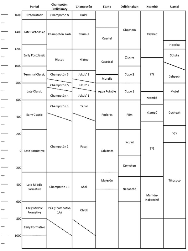
Figure 3: Ceramic chronology for the Río Champotón drainage and contemporary complexes.
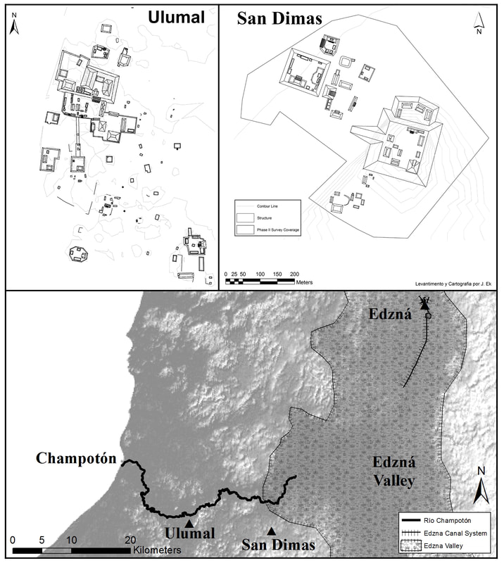
Figure 4: Communication routes between Late Classic centers in the Río Champotón drainage and the regional polity of Edzná. Ulumal and San Dimas were connected to the Gulf Coast via the Río Champotón, while a canal extending south of Edzná would have connected the latter city with the headwaters of the Río Champotón in the Edzná Valley.
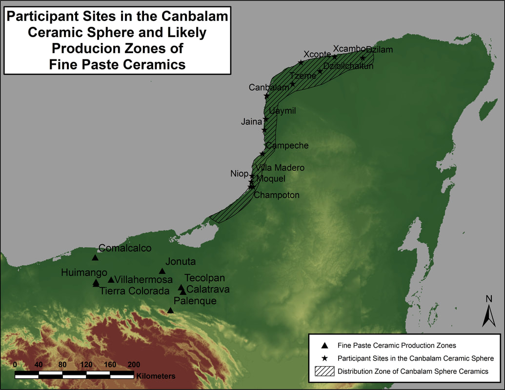
Figure 5: The spatial distribution of the Canbalam ceramic sphere and documented production loci for fine paste ceramics.
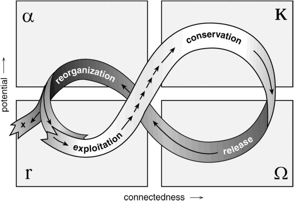
Figure 6. A graphic representation of an adaptive cycle (Holling et al., 2002).