Phase II: Intensive Settlement Survey
|
The second phase of the CRSS research consisted of full coverage mapping within a sample of settlements identified in the regional reconnaissance in the Río Champotón drainage and adjacent coastal margin. The survey consisted of intensive mapping within seven sites, including various intact parts of Chakanputun (surrounding modern Champotón and the town of Paraiso), Niop, Rancho Potrero Grande, Kaymuch, El Zapote, Ulumal, and San Dimas. Samples of materials from surface collections during the survey provided important information about site chronologies. The Phase II settlement survey data formed the broader sample from which test excavation units were selected in Phase III testing.
|
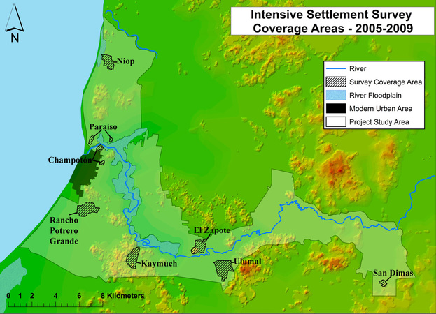
Zones of intensive survey and test excavations (Phases II and III) of the CRSS project. The project study area was reduced to the Río Champotón drainage and adjacent parts of the coastal margin, with seven zones selected for survey and testing.
|